blah blah blah
Snows Mountain
Length: 4.1 mile loopDifficulty (click for info): Easy
Elevation Gain: 1250 feet (+50 feet on descent)
Rating (click for info): 5/10
Elevation: 2782' (west knob) and 3031' (true summit)
Prominence: 157' (true summit)
Driving Directions:
Trailhead and parking area are on Boulder Path Road in Waterville Valley, NH. Drive 11.2 miles northeast on Rt. 49 from exit 28 off I-93, and Boulder Path Road will be on the right as you round a corner to the left by the golf course. This is 1.0 mile after passing Tripoli Road and the entrance to the ski area. Drive 0.5 miles on Boulder Path Road and look for a large dirt parking area on the right just before Cascade Ridge Road. This is the parking for Snows Mountain Ski Area. Click here for a Google map.
About the Hike:
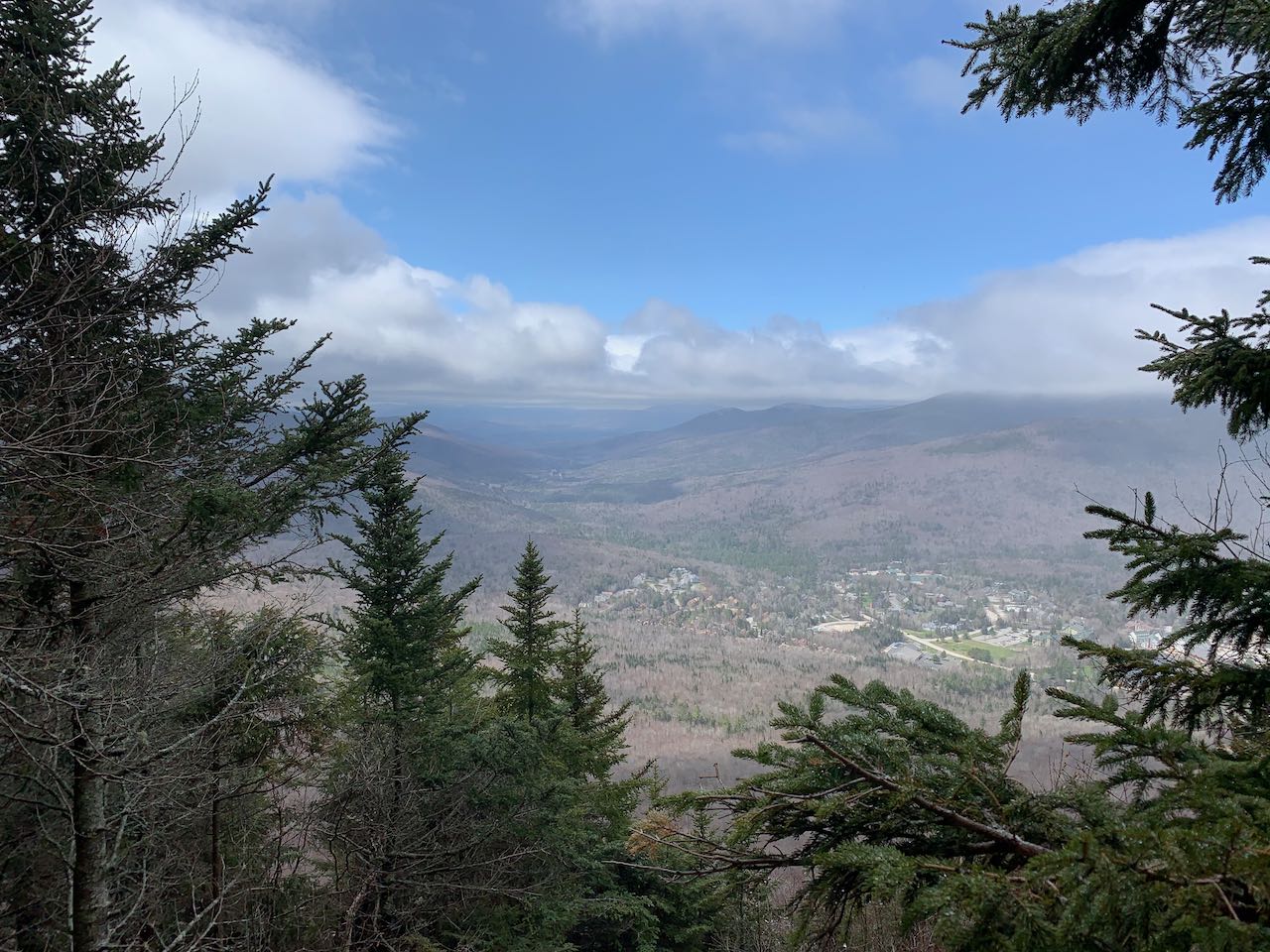
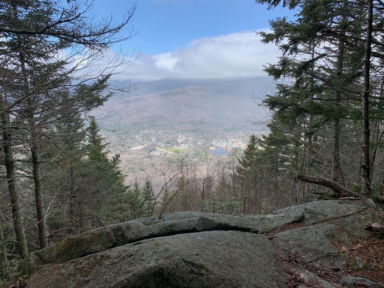
Snows Mountain is a long, finger-like ridge extending from the Sandwich Range out into the center of Waterville Valley, without much of a defined summit. The highest point of the two and a half mile long ridge is located on the east end and rises about 150 feet over Lost Pass, one of the most remote areas in the Sandwich Range Wilderness. This true summit is thoroughly wooded over and unreachable by trail. On the lower western end is the historic Snows Mountain Ski Area, which has long ago aged beyond its snowsports use and is now utilized by mountain bikers. The Snows Mountain Trail makes a four-mile loop along the ridge starting from the old ski area and ending at a rocky knoll halfway to the actual summit. Two openings at the top of the loop provide decent views over Waterville Valley, and the trail explores some enchantingly lush forest along the ridge.
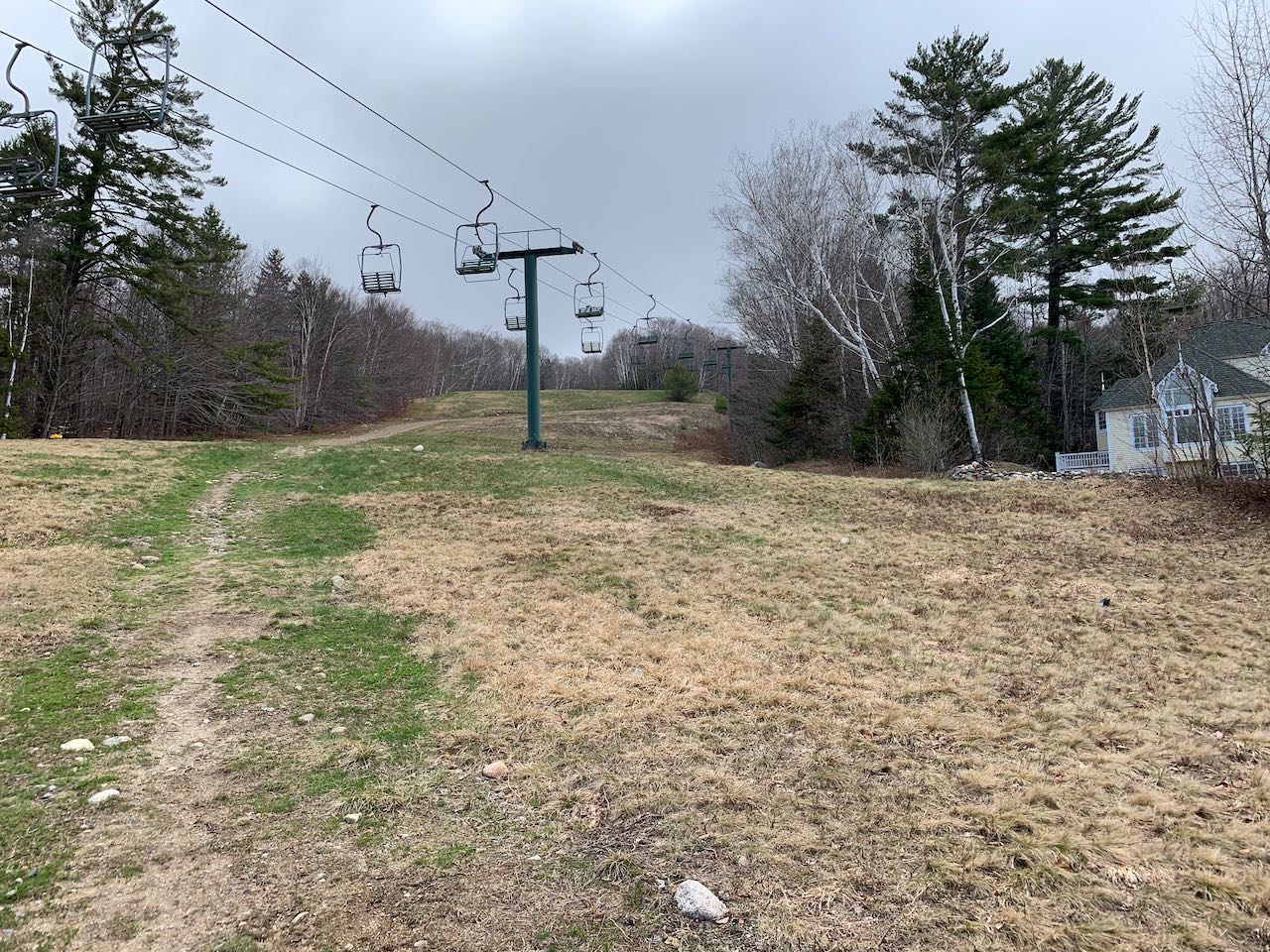
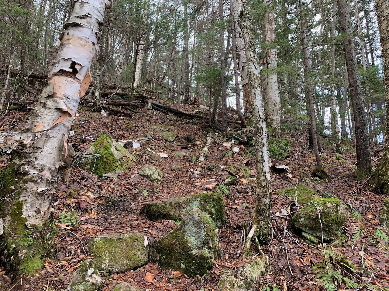
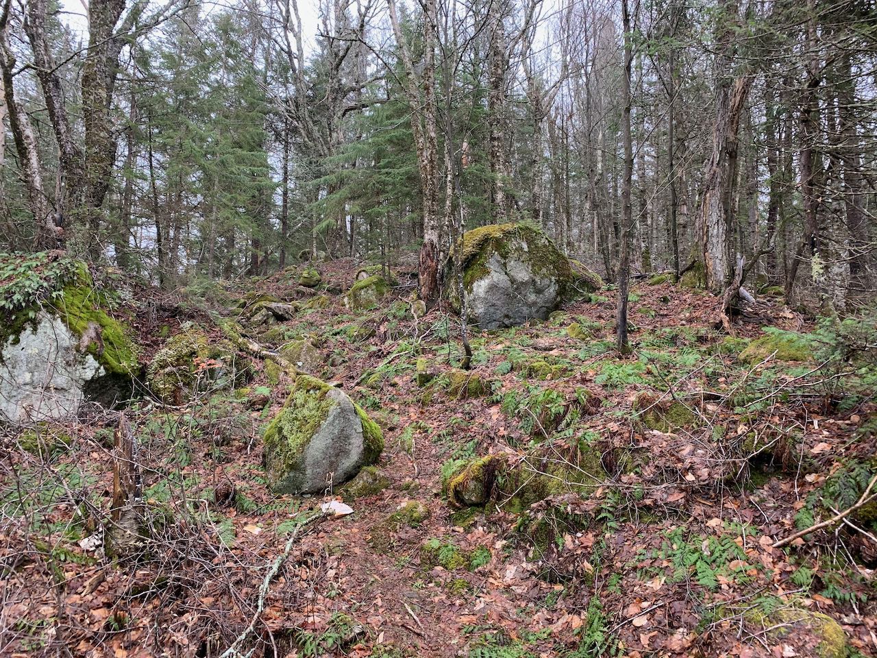
From the parking area, walk to the back of the nearest building and go behind it toward the chairlift. Walk uphill on the left side of the ski trail alongside the ski jumps on a lightly worn foot path, soon joining an access road. Follow the road uphill as it weaves back and forth across the trail. As you come around to the right edge of the ski trail, and the ski slopes uphill fork, look for the signpost where the trail veers off into the forest. You have come 0.3 miles so far. The trail runs on the level through dark woods and passes a small spring before swinging to the left to climb gradually. After crossing another seasonal stream, arrive at a trail junction with Greeley Ledges Trail, which connects to the top of the ski slopes. Now 0.4 miles into the woods, continue straight on Snows Mountain Trail. It heads uphill amongst mossy boulders for 0.3 miles to attain the crest of the ridge. At this point, pay attention to a sign to stay on the trail as you approach a cross-country ski path down to the left and a couple beaten paths connect to it. The trail continues in the upslope direction just to the side of the ridge, but remains mostly flat on this gentle lower section. After 0.2 miles, watch for a sharp right turn where an abandoned trail continues ahead. It climbs to a more defined ridge crest and follows it straight uphill to where the mixed birch forest transitions to conifers. The trail also becomes steeper and stonier for a bit, until it passes over a brief high point about half a mile from the turn. It dips to come beneath a towering tree canopy, then weaves uphill through some open woods and low brush to reach the tip of the loop. At this point, follow a spur path straight ahead for 0.1 miles ahead to reach the top of a little ledgy knoll, barricaded by uprooted trees. There is not much of a view to be found here, but if you stand at the highest point of the rock, you can see over the treetops over to the shoulder of nearby Sandwich Dome.
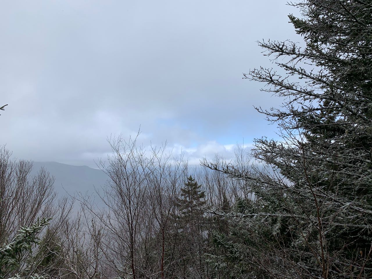
Return back to the loop trail and bear left to continue on the other fork. The trail descends more quickly down the steeper southern side of the mountain, and in 0.1 miles, you arrive at a much more open cleared viewpoint. From this window in the trees, you can enjoy a nice view down over the town center and out through the valley of the Mad River. On the opposite side of the valley, you can see the two rocky summits of Mts. Welch and Dickey, as well as the loftier Mt. Tecumseh with its ski slopes, and the ridge of Green Mountain between them. Continuing down the trail, it cuts across the steep slope, then turns straight downhill and drops a bit of elevation to join up with the bed of an old logging road after 0.15 miles. With better footing cut into the slopes, the trail descends well below the crest of the ridge. It eventually leaves the road bed, and after 0.65 miles, crosses another little-used cross-country ski trail in a rocky patch. Head straight through the junction, following the signs. The trail continues downhill, meandering through bright, verdant forest and crossing several small brooks. After another 0.7 miles, the trail pops out near one of the resort houses around the ski area. Walk down the driveway to the road and follow the road down for 0.3 miles until you see the road you drove in on ahead. At this point, turn right and follow a sidewalk between the several tennis courts. This will bring you back past the chairlift building and to the parking area in 0.2 miles.
Printable directions page